
How to Research Land Before Metal Detecting
Learn a practical, repeatable way to investigate a permission before visiting.
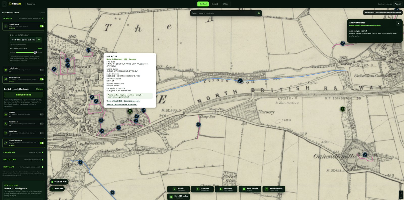
Illustrations should use genuine research screenshots. Research evidence does not guarantee finds.
Start with a question
Rather than looking for a promising field at random, ask what the land was used for. Was it crossed by a route, close to an old settlement, or part of a changing agricultural landscape? A clear question makes each map layer more useful.
Establish the modern location
Identify the permission boundary and familiar landmarks on current mapping. Check access arrangements with the landowner and make a note of modern roads, watercourses and field edges. These anchors help you align older evidence accurately.
Work backwards through the evidence
Compare historic mapping with the modern view. Look for buildings that have disappeared, tracks that change direction and boundaries that no longer exist. A feature shown on one old map is a clue, not proof of what survives on the ground.
Bring the clues together
Use DetectraPro research layers to compare historic routes, sites and other available records. Analyse This Area can help summarise evidence within a selected area; examine the underlying sources before drawing conclusions.
Check permissions and protections
Landowner permission is essential. Check protected sites and any restrictions that apply before detecting, and follow the relevant reporting rules for finds. Research does not override legal or ethical responsibilities.
Put your research into practice
Try DetectraPro’s research tools in the free demonstration area, or read the full guide to using each map feature.
Always obtain landowner permission and check relevant protections, restrictions and finds-reporting obligations before detecting.